|  | | 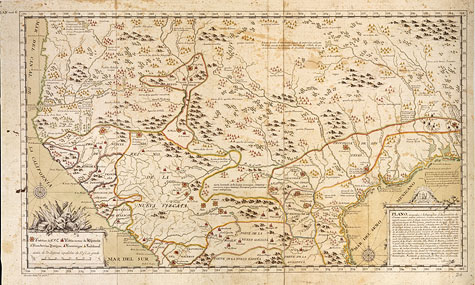 | | | Plano corográfico y hidrográphico de las provincias... | | | This map was originally drawn as part of the 1726-27 inspections of presidios in northern New Spain known as the Rivera expedition. The 1727 version was drawn by Don Francisco Alvarez Barreiro, the principal engineer for the Rivera expedition. | | | Source:St. Pancras Map Library of the British Library, Additional MS. 17650.b. Reproduction of this image is prohibited | |
| |
|