|  | | 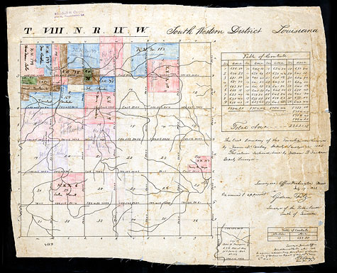 | | | 1830s Plat Map | | | This plat map from the 1830s shows the "Village of Adois." This came to be called "Spanish Town," and later, "Old Spanish Town" by the Anglo-Americans. The people living there would have called it Adaes. A traveler in 1833 described it as "...that extraordinary village of Adayes, about three leagues n. west of Natchitoches, so totally distinct and different from anything else found in the United States, houses streets, manners, and customs are Spanish with an air of the seventeenth century, apparently as complete as though taken from Spain" (F. Mignon Collection, bound volume 183, page 186, Cammie G. Henry Research Center, Northwestern State University, Natchitoches, Louisiana). | | Photo credit: Sonny Carter
Source: Northwestern State University of Louisiana, Watson Memorial Library, Cammie G. Henry Research Center, Map Collection, #179. | |
| |
|