|
|  |
|
 |
|
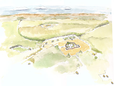
| General Site Reconstruction, 18th century. |
|
| This illustration gives depth and life to the Urrutia map. Sergio Palleroni illustrated the elements of the Urrutia map on an air photo of Los Adaes taken by Tommy Hailey, Northwestern State University. The caminos to the north and west on the Urrutia map are still visible today as subtle gaps in the vegetation, and it some places, depressions in the ground. Another feature visible on the air photo was the wooden timbers that mark the wall of the presidio, which was verified by archaeological excavations. Finally, the roughly east-west ridgeline depicted on the Urrutia map still exists today, and allowed estimations as to where the houses and gardens might be located. |
|
| Source: Illustration by Sergio Palleroni, 2004 |
|
| |
|