Tree Dam
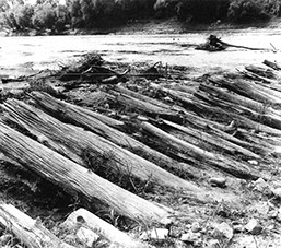
A 100-foot-long part of the tree dam at the lower (main) dam was clearly visible during times of low water in the 1980s. Archaeologists recorded parts of 146 logs that were above the water level, and others were just beneath the water. The logs were very well preserved. Brick and stone rubble was found piled on the upstream ends of the logs.
Archaeologists dug a trench about 5 feet wide and 23 feet long to learn more about the tree dam. They found that the tree limbs had been cut off, unlike those in the historical picture. By observing the knots on the tree trunks, archaeologists could tell that many of the trees were positioned with their tops downstream. That was opposite of the design in the historical illustration. The tops of the trunks had been shaped into a point. Archaeologists found sand and mud between the logs, and brick and stone on top of them.
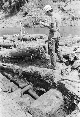
(Top Right) Archaeologist drawing a map of logs uncovered during the tree dam excavations. Courtesy of Coastal Environments, Inc.
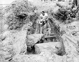
(Left) Tree dam section of Lower Bailey's Dam. Third layer exposed with excavator perched on third log layer, facing northwest. Courtesy of the Library of Congress: HAER LA, 40-ALEX. V,2-19.
(Lower Right) Closeup view of logs exposed in tree dam section of Lower Bailey's Dam, facing southwest. Courtesy of the Library of Congress: HAER LA, 40-ALEX. V,2-13.