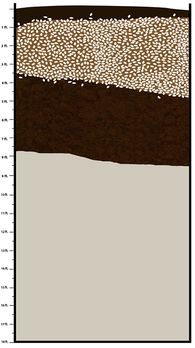
When archaeologists excavate a site, they may find different layers of dirt and shell as they dig down. Archaeologists call these layers strata (stratum, singular). They try to link each stratum to a time period or activity at the site. Because people continued to dump dirt and shell on the Bayou Jasmine site as they lived there, the oldest strata are at the bottom. The most recent activity should be at the top of the site, but Bayou Jasmine is different. Explore the top spoil stratum to learn why.
When researchers dig at a site, they can see the strata in the wall of the excavation. They carefully measure and draw a map of the layers. This map, called a profile, records the strata and helps tell the story of the site from the first activities to the last. Archaeologists label strata from the top to the bottom, which is the way they excavate. However, if you want to learn about this site from beginning to end, you would explore the profile starting at the bottom.
Take your choice, as you get to know more about the history of Bayou Jasmine. Click on the strata to learn more about the site.

Download Section (PDF 995 KB)