Trade and Travel
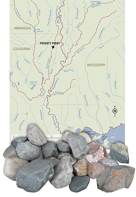
Poverty Point was at the heart of a huge exchange network. This was in no small part due to its location. American Indians built the site on Macon Ridge in northeast Louisiana. This ridge, which is naturally elevated, is surrounded by many rivers. The largest of these is the mighty Mississippi River. Directly along the eastern edge of the site flow the waters of Bayou Maçon.
Given the risk of flooding, it may seem foolish for people to have built the site near so many rivers. In reality, the elevation of Macon Ridge kept the site safe from floods. Plus, rivers were the highways of the ancient world. People used them to trade, travel and share news.
The only major drawback to living at Poverty Point was that there were no rocks near the site. This would have been a problem for people who relied on stone tools. Without trade or travel, people at Poverty Point would not have been able to make the things they needed to survive.
Archaeologists are not really sure how things like stone arrived at the site. People either brought items to the site for trade or went from the site to get them. Perhaps they did both. In any case, Poverty Point may have received over 70 tons of rocks and minerals! These materials came from as far north as Iowa and as far east as the Appalachian Mountains.
Many rivers surround Poverty Point. This would have made trade fairly easy for the people of Poverty Point. Rivers enabled them to carry things, especially heavy things like rocks, more quickly by water rather than by land. People used dugout canoes to travel and haul their goods along these waterways.
Next
Back
| © 2015 Louisiana Division of Archaeology - click here to return to Discover Archaeology's Interactive Exhibits. |